Category Archives: Old New York In Photos

Series: Old New York In Photos

Old New York In Photos #28 – New York City Early Color Photos

New York City In Old Color Photographs At The Turn Of The Century

Mulberry Street Detroit Publishing Company

Mulberry Street in color New York City 1900

Life was colorful in turn of the century New York City. But because almost all the photographs we see from that era are in black and white, it is hard to imagine what the city looked like in its full color glory.

The Library of Congress holds the incredible collection of The Detroit Publishing Company who manufactured postcards and chronicled the world with their photographs from 1880-1920.

One of the processes used to achieve color was called the photochrom. Photochrom’s are color photo lithographs created from a black and white photographic negative. Color impressions are achieved through the application of multiple lithograph stones, one per color. In 1897, the Detroit Publishing Company brought the process over from Switzerland where it was first developed.

The images presented here were eventually used for postcards. Here is a look at New York circa 1900 in high resolution color photographs. Click on any image to vastly enlarge.

South Street Brooklyn Bridge 1900 Detroit Publishing

South Street and Brooklyn Bridge 1900

Looking north along South Street with the Brooklyn Bridge in the background. This was still the age when shipping and boats crowded the harbor.

City Hall 1900 Detroit Publishing

City Hall New York City 1900

City Hall looking northwest with a sliver of City Hall Park on the bottom extreme left. Continue reading

Old New York In Photos #27 – Fifth Avenue Looking North From 51st Street – 1913

Fifth Avenue Looking North From 51st Street – 1913

Fifth Avenue 51st Street 1913

In this one hundred year old view of Fifth Avenue, we see some of the many methods of transportation that New Yorker’s took to get around the city.

A double-decker Fifth Avenue bus ambles to its terminus at 22nd Street and is packed with riders on the top deck taking in the sights. There are horse drawn carriages and many types of automobiles traveling both north and south as Fifth Avenue was a two way street until 1966.

And of course pedestrians crowd the sidewalks on this brisk sunny day.

A couple of things to take note of: Continue reading

Old New York In Photos #26 – Upper Broadway

Two Old Views of Broadway, Bordering Washington Heights

Broadway 153rd Broadway 158th Church of the Intercession

These rural looking scenes are of The Boulevard, now known as Broadway taken around 1895. On the left is Broadway and 153rd Street and on the right, Broadway and 158th Street.

At Broadway between 153rd and 154th Street was the approximate site of Washington’s second fortification of entrenchments in the Battle of Manhattan during the Revolutionary War in 1776.

On the western corner of Broadway and 158th Streets stood the second building of the Church of the Intercession. The congregation moved into their larger, current building at Broadway and 155th Street in 1915.

Old New York In Photos #25 – Street Scene 42nd St. & Broadway 1915

42nd Street and Broadway New York Times Building 1915

42nd st Times Building 10 3 15

We have previously featured an overview of the Times Tower Building and Times Square. Now we present a street level view looking west from Broadway. The date is October 3, 1915 and there are a handful of people milling about on the street. Continue reading

Old New York In Photos #24 – Fort Tryon

Fort Tryon Hill As Seen From Fort George Hill

Fort Tryon Hill

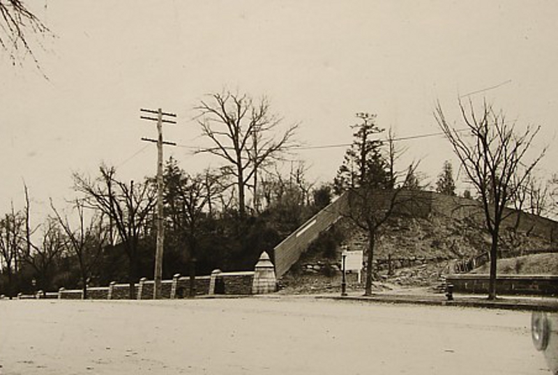
The northern area of Manhattan: Washington Heights, Inwood and Fort Tryon were among the last areas of the island to be developed. Much of the area remained somewhat rural until the early 20th century as evidenced in this undated photograph.

The area of Fort George Hill was at the time of the Revolution called Laurel Hill. Upon it the British constructed an extensive fortification called Fort George. The Fort was located at what would today be 192nd Street and Audubon Avenue. The neighborhood that sprung up around this area was given the name of Fort George Hill.

Fort Tryon Hill was one of the last portions of Manhattan to pass from Indian ownership to the possession of the Dutch. The aboriginal owners were the Wickquaskeek corrupted to Wickers Creek Indians.

Fort Tryon Map Showing Land Ownership and Parcels

Fort Tryon Map Showing Land Ownership and Parcels

Fort Tryon was named by the British for Major General William Tryon (1729–1788), the last British governor of colonial New York. Fort Tryon was part of a series of posts running along the Hudson River during the revolutionary war.

Between 1901 and 1904 Cornelius Kingsley Garrison Billings acquired several property lots from many different owners around Fort Tryon Hill. Billings had begun assembling an estate that culminated in a stately mansion being built which was completed in 1907. The mansion can be seen on the right hand side of the photograph. Billings sold the mansion in 1916 to John D. Rockefeller. In 1917 Rockefeller donated the Billings estate and surrounding properties which he had acquired to New York City and the area was turned into Fort Tryon Park. The mansion was destroyed by fire in 1926.

Old New York In Photos #23 – Subway Excavation Along Broadway & 49th St. 1901

Subway Excavation, Broadway and 49th Street – 1901

While the MTA is currently striving to build the new Second Avenue subway without disturbing businesses along the route, the Interborough Rapid Transit Company (IRT) had no such compunction about hampering businesses as demonstrated by this photograph taken on November 26, 1901.

We are looking north along Broadway towards 49th Street. The J.B. Brewster Carriage Continue reading

Old New York in Photos #22 – History of Times Tower Building & Times Square In Detail

Times Square And The New York Times Tower Building 1908

Times Square featuring The Times Tower 1908 – click to vastly enlarge (six megabytes!)

Times Square is burgeoning with activity in 1908 and there is so much to see in this picture.

This photograph of Times Square was part of The Detroit Publishing Company collection, now housed at The Library of Congress. The company made picture postcards from these original photographs at the turn of the century.

The area formerly known as Longacre Square became Times Square after the New York Times opened their iconic flagship office building in 1905 at what would become known as “the crossroads of the world,” the southern end of Times Square, the triangular intersection of 42nd and 43rd streets where Broadway and Seventh Avenue diverge.

Flatiron Building in 1903

The Times Tower Building design is reminiscent of the Fuller Building, which became popularly known as the “Flatiron Building” soon after it opened in 1902 between 22nd and 23rd Streets where Broadway and Fifth Avenue intersect. The two buildings don’t look alike at all. But because they were each built on irregular plots of land, the triangular buildings both resemble flatirons.

The original Times Tower Building was a Gothic structure of beautiful light limestone and featured intricate terra-cotta and granite on the facade. More about the building later in the article. Continue reading

Old New York in Photos #21 – Upper East Side Farm 1880

A Farm On The East Side Of Manhattan Circa 1880

No information beyond the basics could be found on this gem.

We are looking east towards the East River at the Krappe family farm located at East 87th Street between Avenue A and Avenue B (now renamed York and East End Avenues).

I believe Gracie Mansion is on the left side of the photograph seen partially behind the trees. If anyone has further information, please share.

Old New York in Photos #20 – The Boulevard & 104th Street

The Boulevard Looking South From 104th Street

Looking at this tree filled landscape it is hard to believe this is New York City. This idyllic scene was photographed on the morning of July 4, 1888. Until 1899, Broadway above 59th Street was known as The Boulevard. Continue reading

Old New York in Photos #19 – First Traffic Light Signals

First Traffic Light Signals –  Fifth Avenue and 34th Street, 1922

The Beginning of New York City’s Traffic Lights

This ornate traffic light at 34th Street, was one of seven put up in New York City on the heavily traveled Fifth Avenue in 1922.

The city had experimented with traffic signals in 1917 when a device invented by an engineer, Foster Milliken, was installed at the intersection of Fifth Avenue and 57th Street. The device was a revolving flashlight that would flash signals as red to stop and green for go.  This may sound ridiculous now, but in the early days of traffic signals there was no standard for color relating to traffic. Continue reading